

Garmin GPSMAP 65s handheld GPS with 2.6-inch color display, altimeter & compass
Reviews
Product description
What it is and why people buy it
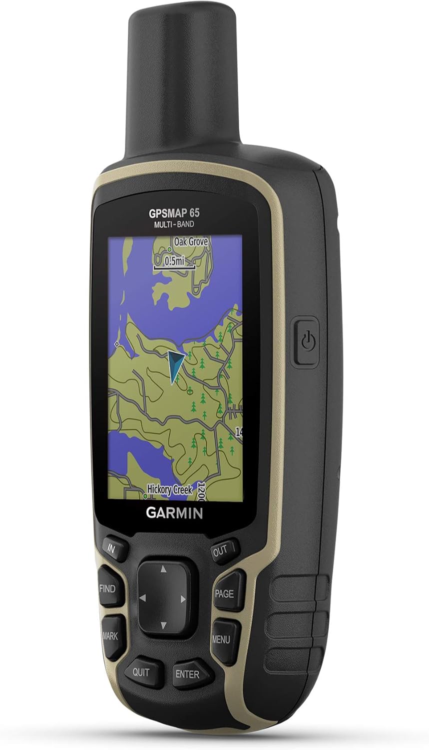
The Garmin GPSMAP 65s is a button-operated handheld GPS made for off-the-grid navigation—trail time, remote work sites, hunting trips, and day trips where cell service is unreliable. The big promise on paper is straightforward: a sunlight-readable 2.6” color display plus expanded satellite support and multi-band technology aimed at more reliable positioning when you’re in places that normally mess with GPS.
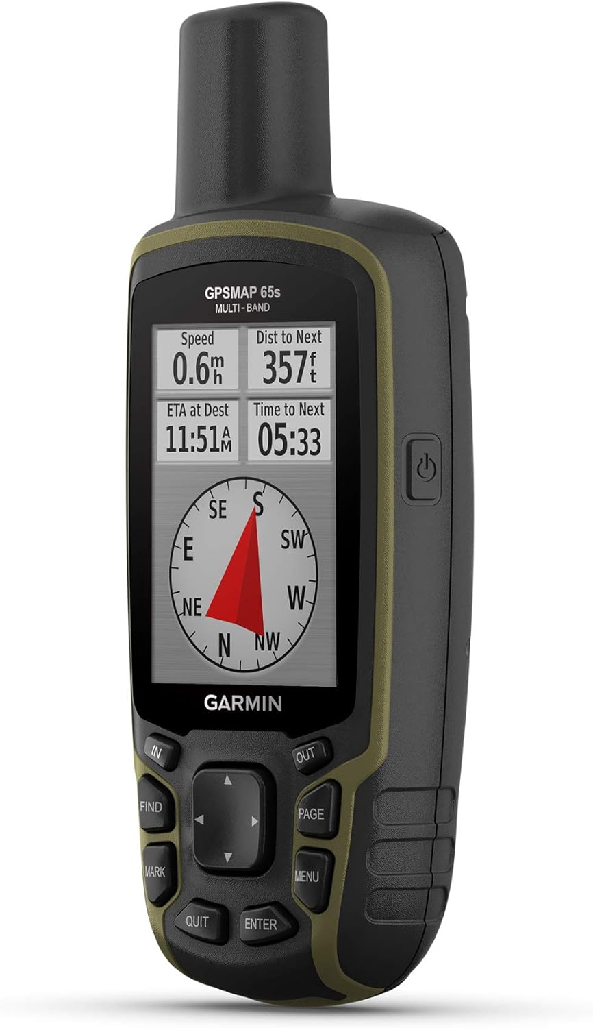
If you’ve ever had your location “jump” around between tall trees, steep terrain, or canyon walls, the GPSMAP 65s is built for that exact kind of frustration. And it’s not just a map screen either, it’s positioned as a go-anywhere navigation tool thanks to a 3-axis compass and a barometric altimeter for navigation awareness when conditions get tricky.
The essentials (display, satellites, and maps)
A standout detail here is the 2.6” color display designed to be readable in sunlight. In real-world use, that matters more than people expect—when the screen washes out, you stop trusting what you’re seeing. On this unit, the emphasis is on being able to glance and confirm where you are without babying the brightness.
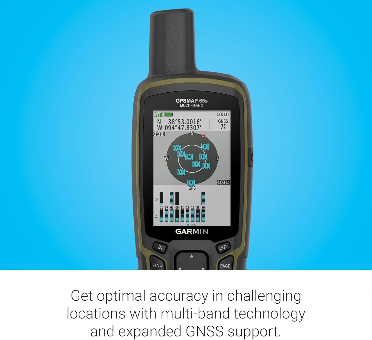
Next comes the satellite side. The GPSMAP 65s includes expanded global navigation satellite systems (GNSS) support and multi-band technology. On paper, that translates to better positioning in challenging areas such as steep country, urban canyons, and forests with dense trees. It’s the kind of feature you’ll notice most when your alternative (a phone with spotty reception or inconsistent GPS) becomes unreliable.
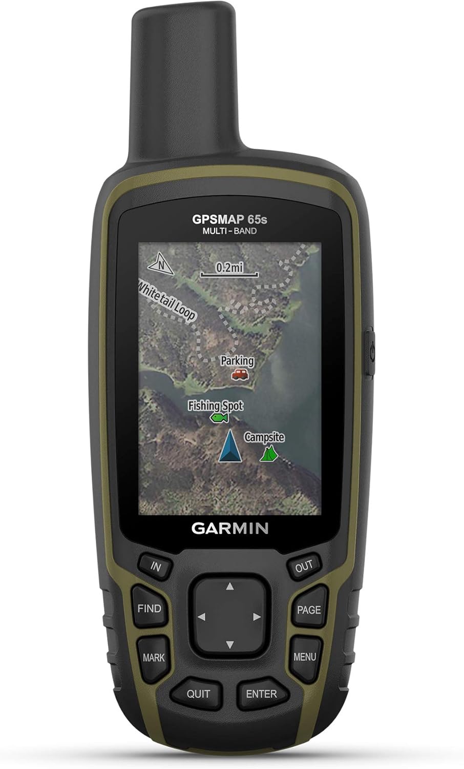
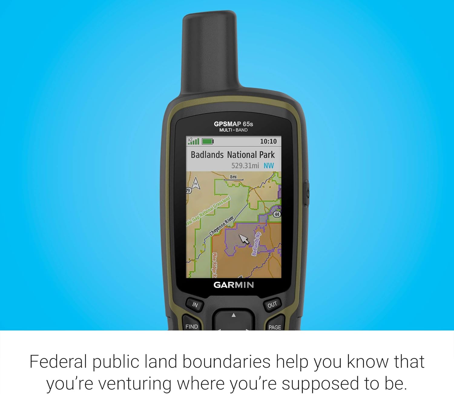
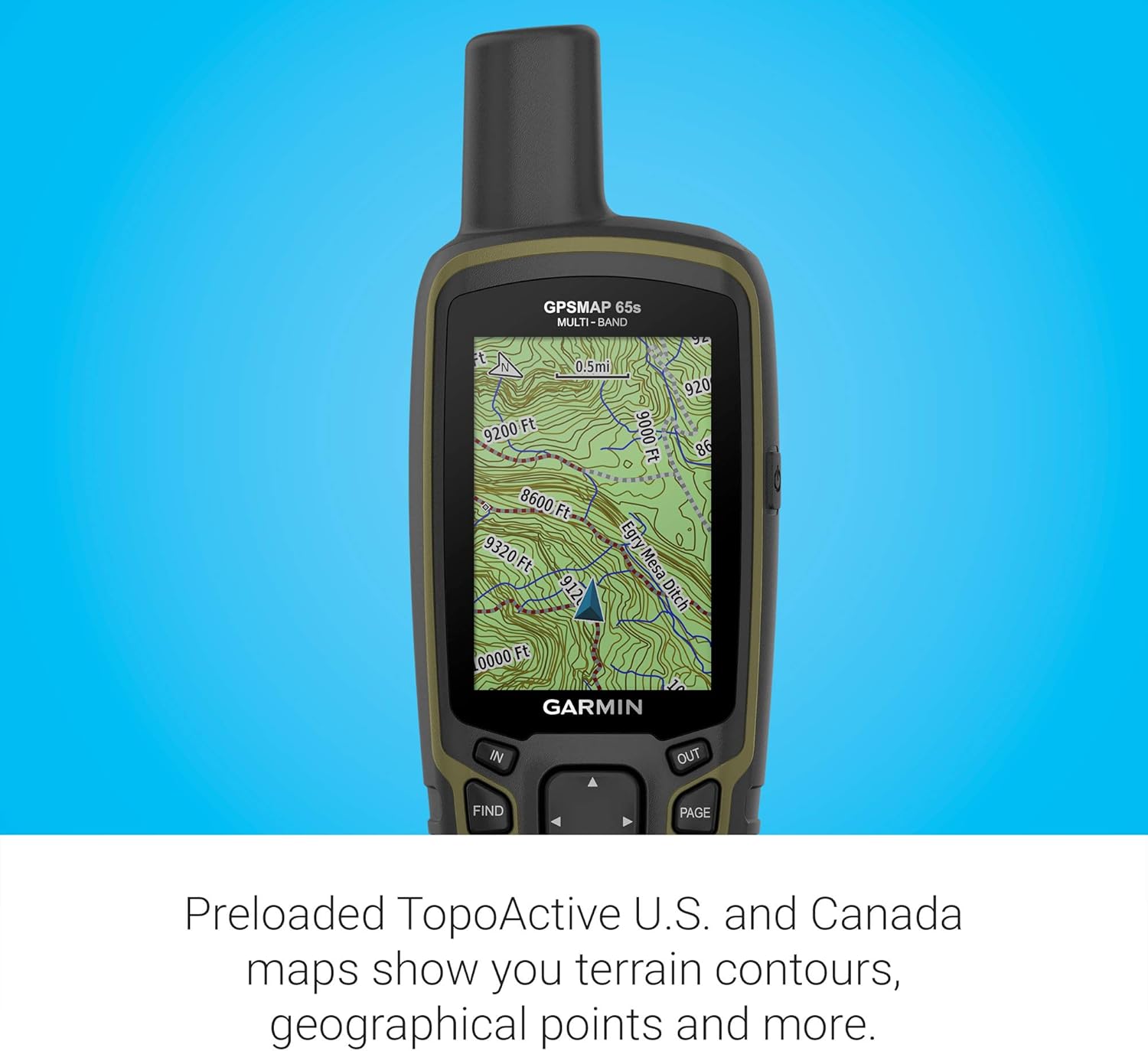
It also includes routable TopoActive mapping, plus a federal public land map for U.S. use. If you plan routes or want maps that actually support navigation rather than just basic tracking, that’s one of the reasons this model is often considered for outdoor use.
Using it day-to-day: what stands out in the field
This is a handheld you operate with buttons, which can feel more deliberate than relying on a touchscreen when you’re wearing gloves, moving around, or just don’t want to tap at the wrong moment. Imagine you’re hiking and approaching a junction: you stop for 10 seconds, check your route line and your position on the color display, and use the compass/altimeter data to keep oriented as the terrain changes.
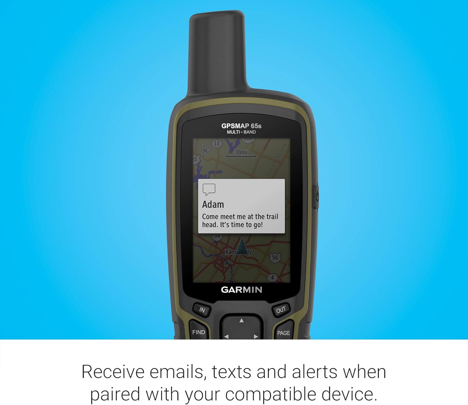
The GPSMAP 65s also supports working with the Garmin Explore website and app. You can manage tracks, routes, and waypoints and review statistics from the field. Practically, that’s useful if you like planning before a trip, then syncing/looking back afterward instead of treating every outing as a one-time event.
One thing to keep in mind: this app compatibility requires a compatible smartphone. If you’re the type who prefers zero phone involvement, you may not get the full value of that workflow.
What you’ll notice—and the limitations to consider
Strengths first: the combination of a sunlight-readable color screen, expanded satellite capability, and built-in navigation sensors (3-axis compass and barometric altimeter) is geared toward accuracy and orientation where conditions are rough. The included TopoActive mapping and U.S. federal public land mapping add to the “ready to navigate” feel.
That said, it may not be the best match if your main goal is casual, city-based navigation. This class of handheld tends to shine when you’re outdoors and want dependable positioning more than you want sleek convenience.
Also, while the text confirms expanded satellite support and multi-band tech for challenging locations, it doesn’t spell out performance specifics like how much accuracy improves in every scenario. So it’s smart to view it as “built for tough environments,” not a guarantee that every signal obstruction will disappear.
Who it fits best (and who should think twice)
It makes sense if you regularly navigate outdoors, especially where trees, steep terrain, or canyon-like surroundings can challenge standard GPS. You’ll likely appreciate it if you want a go-anywhere handheld with meaningful navigation tools built in, not just a map view.
It might not suit you as well if you only need occasional navigation on well-covered routes, or if you’re planning to rely entirely on phone apps and touch screens. This device sits in the “get reliable navigation in the field” mindset, which is great—just not ideal if your needs are mostly urban and low-stakes.
Tech summary (key specs from the description)
- Display: 2.6” color display designed to be sunlight-readable
- Navigation sensors: 3-axis compass and barometric altimeter
- Satellite approach: expanded global navigation satellite systems (GNSS) and multi-band technology
- Maps: routable TopoActive mapping plus federal public land map (U.S. only)
- Connectivity workflow: compatible with Garmin Explore website and app (smartphone required)
Is it worth it?
Buy the Garmin GPSMAP 65s if you want a button-operated handheld GPS that’s built for challenging navigation areas—steep country, urban canyons, and dense forests—plus a sunlight-readable color screen you can actually read outside. The inclusion of routable TopoActive mapping and U.S. federal public land coverage makes it easier to get going without piecing together options.
Skip it (or at least look more carefully) if your usage is mostly casual indoor planning or city navigation, or if you don’t want to involve a smartphone at all. It’s a capable field tool, but it’s not trying to be a simple everyday GPS convenience device.
Quick questions before you buy
FAQs
Does the GPSMAP 65s work in the U.S. for public land maps?
Yes, the description states it includes a federal public land map for U.S. use.
Do I need a smartphone to use Garmin Explore?
Yes—Garmin Explore website and app compatibility is described as requiring a compatible smartphone.
What does “multi-band technology” help with?
Based on the description, it’s intended to support optimal accuracy in challenging locations like steep country, urban canyons, and dense forests.
Is the screen readable in bright outdoor light?
The 2.6” color display is specifically described as sunlight-readable for easier viewing.